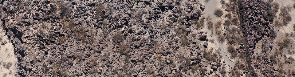
I have to admit: Flying an unmanned aerial vehicle (UAV) such as the Trimble UX5-HP is a lot easier than flying a kite over lava flows. We covered several square kilometers in no time with this bird! There were two location: the south of Iceland (the Laki lava flow) and in the north of Iceland (the Holuhraun lava flow). We worked with a great group of students in the field participating in the Keck Geology Consortium. They helped us run our mobile UAV airport! I’ll post more details about our field work and the student projects soon. For now, here are a few images of us doing our volcanological mapping. The data will result in orthoimage data at 1-4 cm per pixel, and digital terrain models at 10 cm per pixel!
-

- This is a taste of the data we’re creating at the Lunar and Planetary Laboratory. On the left is an orthoimage of a series of cones along a fissure in the Laki lava flow. On the right is a colorized digital terrain model (DTM) of the same area. No scale; map oriented north.

-

- Setting up for launch near the Holuhraun lava flow

-

- Ground control; our mobile UAV port.

-

- Stepping through launch preparations with Dr. Christopher Hamilton.

-

- Removing the pitot tube cover just before launch.

-

- Somewhere out there is an expensive bird that we’re tracking.

-

- Going through post-flight checklist.

-

- It took several flights to cover the area surrounding the vent of the Holuhraun lava flow with the UX5-HP.
