Flying a kite for aerial photogrammetry was difficult because Iceland has relatively unpredictable weather, including the wind. I was able to make a couple of flights in the northern part of Iceland near the Holuhraun lava flow, which finished erupting just a few months before our arrival. Most of our mapping work during this summer of 2015 field campaign was accomplished using DJI Phantom 3 Professional unmanned aerial vehicles (UAVs). You can see more details here at this website, including publication. Much of this work is still underway.
-

- It takes a few people to make the camera system and the kite work together, especially the radio controlled gimbal.

-

- Launching the kite in this area was challenging due to inconsistent winds and rocky terrain.

-

- Here you can see that I have the rig holding the camera suspended from the kite line.

-

- Once the kite and camera are up in the air with good wind, mapping is relatively simple. The camera takes images automatically at an interval I set, and my job is then to just fly it over areas of interest.

-

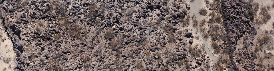
- This image was taken from a radio-controlled gimbal attached to the kite. Here is a place where glacial, fluvial and volcanic processes all take place.
